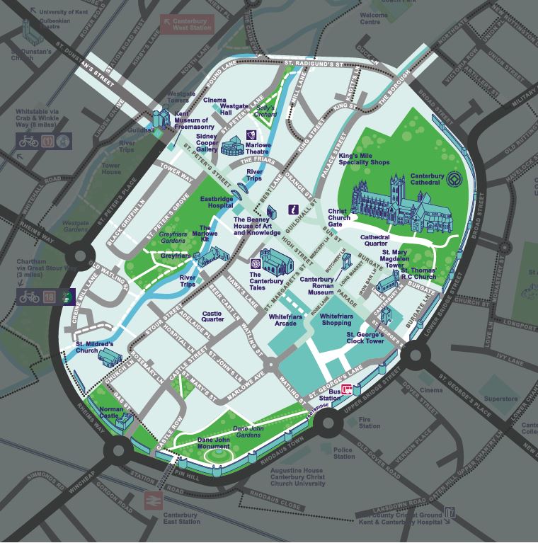
The Business Improvement District for Canterbury covers the heart of the city centre and contains the main retail, office and leisure areas. The BID area was defined as a result of detailed consultation with representatives of each of the key business sectors to gain an understanding of the extent and strength of support for inclusion within the area. From this it was then possible to construct an outline of the area, the result of which is shown below:
The following streets are included, either in whole or in part (A-Z):
Abbots Place, Adelaide Place, All Saints Lane, Beer Cart Lane, Best Lane, Black Griffin Lane, Blackfriars Street, Burgate, Burgate Lane, Butchery Lane, Canterbury Lane, Castle Row, Castle Street, Church Lane, Cobden Place, Dane John Duck Lane Gas Street, Gravel Walk Guildhall Street Hawks Lane, High Street, Hospital Lane, Iron Bar Lane, Jewry Lane, King Street, Knott’s Lane, Lavender Mews, Link Lane, Longmarket, Marlowe Arcade, Marlowe Avenue, Mercery Lane, Mill Lane Northgate (58-74 & 75-89), Orange Street, Palace Street Pound Lane, Rose Lane Rosemary Lane, St Alphege Lane St Dunstan’s Street (5-27 & 67-95), St Edmunds Road, St Georges Lane, St Georges Street, St John Lane, St Margaret’s Street, St Marys Street, St Peters Grove, St Peters Lane, St Peters Street, St Radigund’s Place, St Radigunds Street, Stour Street, Sun Street, Sun Yard, The Borough, The Friars, The Parade, The Precincts, Tower Way, Turnagain Lane, Water Lane, Watling Street, Westgate Hall Road, Whitefriars Arcade, Whitefriars Street, Whitehorse Lane, Worthgate Place
